
Miami Real-Time Flood Map
Floodi shows real-time, neighbor-reported flooding across Miami and Miami-Dade County. Skip the flooded streets and get where you're going.
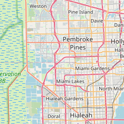
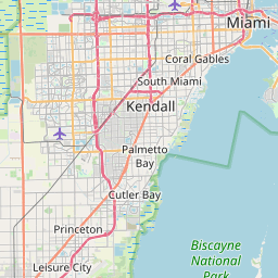


Leaflet © OpenStreetMap contributors
0 active flood reports in Miami-Dade County right now
Community reports — unverified. Always follow official evacuation orders.
Counties covered
- • Miami-Dade County
Why Miami-Dade County floods
Miami sits at sea level on porous limestone, so heavy rain, king tides, and storm surge regularly flood streets in Brickell, Miami Beach, Little Havana, and along the Miami River. Climate-driven sea level rise has made sunny-day flooding a routine event.
Miami-Dade County flooding is driven by Biscayne Bay tides, intense convective storms off the Everglades, and tropical systems crossing all 67 Florida counties. Sunny-day flooding now hits coastal Miami Beach and downtown Miami's Brickell financial district on regular king-tide cycles, while afternoon thunderstorms routinely overwhelm storm drains in Hialeah, Doral, and Kendall. Floodi crowdsources Miami flood alerts in real time so drivers, parents, and first responders can avoid flooded streets before they hit them.
Cities and neighborhoods covered
- • Miami
- • Miami Beach
- • Hialeah
- • Coral Gables
- • Brickell
- • Wynwood
- • Little Havana
- • Doral
- • Kendall
- • Homestead
- • North Miami
- • Aventura
Recent reports in Miami-Dade County
No active official flood alerts are showing for this area right now. Open the live map to check community reports nearby.
Report flooding in Miami-Dade County
See water on a street? Submit a report in 30 seconds — you'll help every Miami-Dade County driver behind you avoid it.
Get alerts for your area
Save your home, work, and your kids' schools as watched zones to get notified the moment flooding is reported nearby.
Miami-Dade County flood FAQ
Open the Floodi map at floodi.app — every pin is a neighbor-reported flood from the last few hours across Miami-Dade County.
Brickell, Miami Beach, Little Havana, downtown Miami along the river, and low-lying parts of Hialeah and Sweetwater see the most repeat flooding from rain and king tides.
Yes — Floodi covers every city and unincorporated area in Miami-Dade, from Aventura down to Homestead.