Florida city flood intelligence

    Fort Lauderdale Flood Map and Live Flood Reports

    Fort Lauderdale flood monitoring reflects the city's extensive canal network, low elevation, and history of intense rainfall events like April 2023.

    Share this page with neighbors during heavy rain.

    NWS data: polled every 15 minLatest USGS gauge: pendingLast community report: No recent reportMonitoring active
    Official data synced monitoring active
    Latest USGS gauge update monitoring active
    Tracking all 67 Florida counties
    Historical flood events tracked
    0 official alerts monitored
    1 community reports processed

    Monitoring NOAA, NWS, USGS, community reports, and historical flood archive signals. Floodi is not a replacement for 911 or official emergency instructions.

    Follow Floodi for Florida flood updates

    Community-powered flood intelligence, built for Florida residents and organizations. Help neighbors avoid flooded roads.
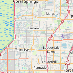
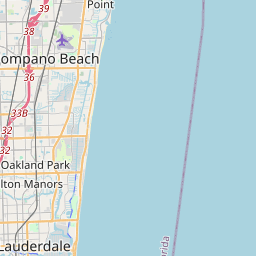
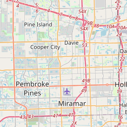
    Fort Lauderdale local flood map

    Leaflet © OpenStreetMap contributors
    0 active reports near Fort Lauderdale
    Community reports — unverified. Always follow official evacuation orders.

    Historical monitoring

    Trending flood activity near Fort Lauderdale

    Seeded from historical Florida flood-prone areas, with live public Floodi reports used when available.

    Open live feed

    Reported areas

    1. Miami Beach king tide zones
      6
    2. Fort Lauderdale drainage corridors
      5
    3. Key West low-lying streets
      4
    4. Fort Myers storm surge areas
      3
    5. Tampa Bay coastal roads
      3

    High severity

    No high severity reported right now — a quiet period, not necessarily a safe one.

    Road impacts

    No road impacts reported right now — a quiet period, not necessarily a safe one.

    Platform monitoring active — Fort Lauderdale

    Official alerts, live gauge readings, and flood history are available now. Community reports add street-level detail — be the first to put local flooding on the map.

    Live monitoring active NWS + USGS + FEMA data AI photo verification

    NWS / NOAA alerts

    No active NWS alerts

    National Weather Service flood watches and warnings are polled every 15 minutes.

    USGS gauge network

    Gauge network active

    Stream gauge readings updated in real time.

    Official data sync

    Live data streams

    FEMA flood zones, NOAA storm data, and NWS warning polygons drawn on the map as published.

    Flood history

    26 documented events

    Historical flood events across Florida provide local context even during quiet periods.

    See flooding nearby? Be the first to put it on the map.

    Your report appears on the live map in seconds — verified by official data signals and AI photo analysis. It helps neighbors, local media, and emergency teams know what's happening on your street.

    Flood Risk Signal

    Moderate

    Moderate

    Transparent MVP signal, not a forecast.

    Recent local reports

    0

    Verified reports

    0

    Road impacts

    0

    Severity overview

    Floodi is monitoring this area. No active community reports are currently verified, but official alerts, gauge data, and historical flood activity remain available.

    Recent reports

    Local flood-prone areas

    Las Olas Boulevard
    Victoria Park low streets
    Flagler Village
    New River corridor

    Historical flood notes

    • April 2023 historic South Florida rainfall event
    • Hurricane Irma regional impacts
    • Hurricane Wilma flooding
    View flood memory

    Fort Lauderdale historical flood memory

    Historical flood data fallback

    View all flood memory
    major

    Fort Lauderdale recurrent flood corridors

    Fort Lauderdale · 2024

    Repeated intense rainfall events continued to stress drainage and travel corridors in Broward County.

    Las Olas Boulevard
    Victoria Park
    Flagler Village
    catastrophic

    Southeast Florida historic rainfall

    Fort Lauderdale and Broward County · 2023

    Historic rainfall caused widespread street flooding, airport closure, stalled vehicles, and major travel disruption.

    I-95
    US-1
    Broward Boulevard

    Common flooding causes

    • intense rainfall
    • canal and drainage backups
    • king tides
    • storm surge

    Surge and king tide context

    Moderate to high along the Intracoastal Waterway and New River.

    High for canal-front and Intracoastal neighborhoods.

    Inland flood context

    Very high due to the city's extensive canal network and low elevation.

    Road impact and storm safety

    Floodi highlights reports with road impacts when community members include them. Community reports may be delayed or inaccurate; Floodi does not replace 911, official emergency alerts, evacuation orders, or local government instructions.

    Useful during storms and heavy rainfall

    Residents can report nearby flooding, share local conditions, and use Floodi as a lightweight awareness layer.

    For HOAs, governments, and organizations

    Floodi supports local awareness pages, embeds, lead capture, partner pilots, and future flood intelligence API access.

    Request a city/county flood dashboard

    Fort Lauderdale flooding FAQ

    Open Floodi, tap Report flooding, confirm the location near Fort Lauderdale, add road-impact details or photos if safe, and submit the report for community awareness.

    Floodi shows recent public community reports around Fort Lauderdale, including road-impact signals when residents include them. Reports may be delayed, incomplete, or inaccurate, so check official sources before travel.

    Local flood-prone areas in Fort Lauderdale include Las Olas Boulevard, Victoria Park low streets, Flagler Village, New River corridor. Floodi tracks community reports and official signals for these areas alongside the rest of Fort Lauderdale.

    No. Floodi is independent community situational awareness and does not replace 911, official emergency alerts, evacuation orders, or instructions from local government and public safety agencies.

    Floodi combines community confirmations, disputes, admin review, public-safe report fields, and official weather context where available. Reports may still be delayed, incomplete, or inaccurate.

    Yes. Cities, counties, HOAs, property managers, media teams, and emergency partners can request a Floodi pilot, map embed, or data-access discussion for local flood awareness.

    No. Call 911 for life-threatening emergencies, never drive through flooded roads, and always follow official instructions from local emergency management, law enforcement, and weather authorities.

    Bring Floodi to Fort Lauderdale

    Cities, counties, HOAs, property managers, media teams, and emergency partners can request local support or a pilot.

    Florida-first, scalable nationwide

    Floodi is currently focused on Florida flood-prone communities while building patterns that can scale to additional cities, counties, and storm-prone regions over time.